
After the scenic, rewarding hike from Cala d’Hort to Cala Bassa the day before, on day 2 I would be hiking on my own so, why not, take up a longer challenge. After considering several options, I went for the simpler one: a hike starting home, heading to the town of Santa Eulària.
I was intrigued by this hike. For one thing, I had never visited any cove on this stretch of the coast.
Not worth going to – too developed, was K’s bottom line. Or, most likely, what my mind made of her words whenever I asked her about it. But further, there was the description given by Tony Bonet’s on his excellent wikiloc page. This stage was no joke, with rugged terrain and two big-ish hills close to Santa Eulària.
To spice it up, I avoided the shortcut to the port and, instead, hiked the extra 3km from Figueretas to the port, including the hike up to Dalt Vila, Ibiza’s beautiful old town.
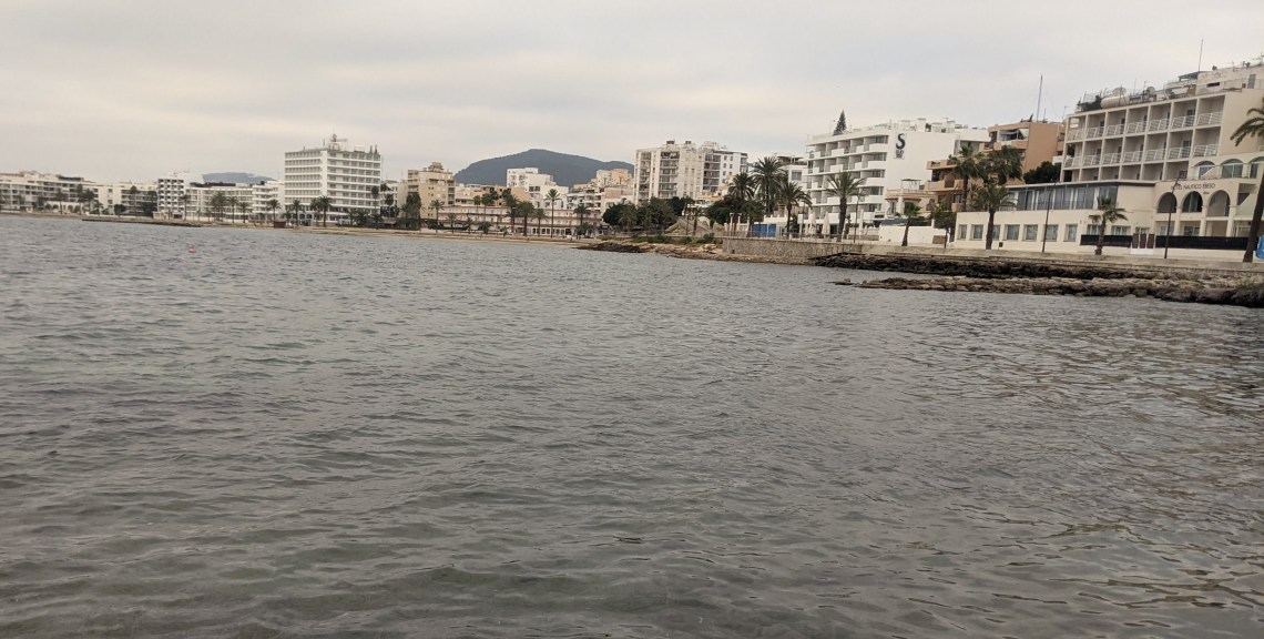


I must admit, I didn’t enjoy most of the walking for the first few hours after the port. It was one of those days in which things don’t feel quite right. For some mysterious reason, I wasn’t able to transfer the gpx track to my Garmin watch, and that bugged me. Further, the walk to Talamanca beach and along it felt like drag, seemingly taking forever. After yesterday’s sights, I regretted having gotten myself into such an urban walk. To top it off, the street that was supposed to take me to the first stretch of unspoilt coastal walk was closed for construction work, and I had to take a long detour on forgettable roads.
I listed to a hiking podcast, and wondered why I wasn’t hiking from Cala Bassa to Santa Agnes. Oh well.

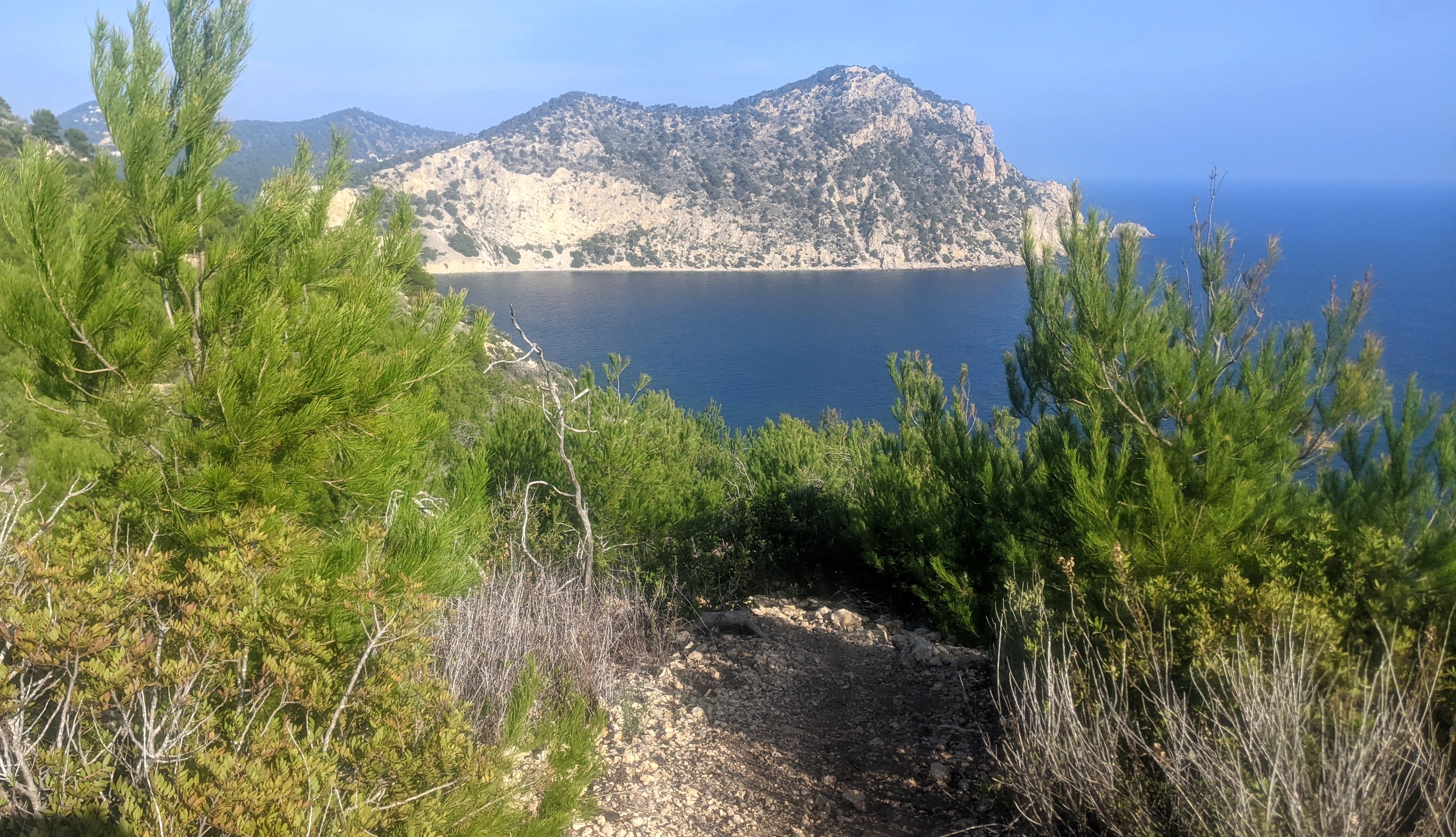
Things picked up a bit for a while around Cap Martinet and Cala Roja, but then the route departed from the coast, past yet another housing area and into the woods, where I encountered mountain bikers, strange stone huts, abandoned buildings and a derelict Seat Panda. Interesting, I thought. The kind of things that you see when you hike in places where not a lot of people hike. B-sides, even in Ibiza.


Back on the coast, I knew that there would be a restaurant open at S’Estanyol, but my grim mood did not allow me to take a break and enjoy an overpriced coffee. Also, I wanted to make headway, as I knew that the toughest sections were yet ahead.


Good thing I did. For it took me what seemed like hours to go through the Roca Llisa urbanization, which offered a mix of relentless climbs, view on construction works, walking on sketchy roads with no sidewalks and a golf course. All to the soundtrack of barking dogs.

As you’ll see on my map, I tried a shortcut, but failed. Call me a chicken, but I turned around at the prospect of having to climbing over a fence and scrambling down a steep ravine full of loose rock, then hitting a trail that went past an old house where an aggressive, unleashed dog might be waiting for me.
Thanks but no thanks.
I finally got to Cala Olivera, where I had a quick lunch. I liked the place. Other than a simple wooden cabin – a beach bar – it was unspoilt.

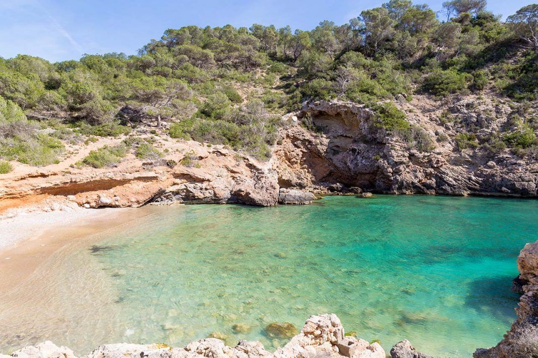
As unexciting as the first part of the hike had been, Cala Olivera signaled the beginning of one of the best sections of coastal walking I have done. First the walk to Sol d’en Serra, and then the strenuous climb up Es Castellar, with gorgeous views and in a sweet afternoon light.


Even the return to “civilization” at the sleepy Cala Llonga resort didn’t ruin the fun. Soon enough I was out of there and tackling the last major climb of the day.
It was on the way down that mountain that I encountered a young couple that looked out of breath. Our conversation went something like this.
Girl: Where does this trail go?
Me: Depends…Where do you wanna go?
Girl: Civilization…
Me: You coming from Santa Eularia?
Girl: We are
Me: And how will you get back?
Girl: Oh, we’ll call for a taxi
I encouraged them to take the scenic route to Cala Llonga. There was a wooden sign at the crossroads, and blue spray painted blazes to follow. Only a few minutes later it dawned on me that it was getting late, they were ill-equipped and seemed to be carrying no water….At least there’s consistent cell-phone signal, I reassured myself.
The last section of the walk was easy enough, gently rolling downhill toward Santa Eulària.


For a moment, I considered walking past town and starting the next stage. I had a trail angel ready to pick me up, after all.
But hey, what’s the point, I thought. It’s almost dark and it’s getting cold.
Let’s slow down, check out Santa Eulària and find a place for a beer!

The facts
Length: 32 km
Elevation gain: +1115m
Time: 8h 28 minutes (including breaks and lunch)
You may check my gpx track here:
